.png&w=640&q=75)
Scan Process
Capture Process
Scanning Duration
Scan Data
Scan Period
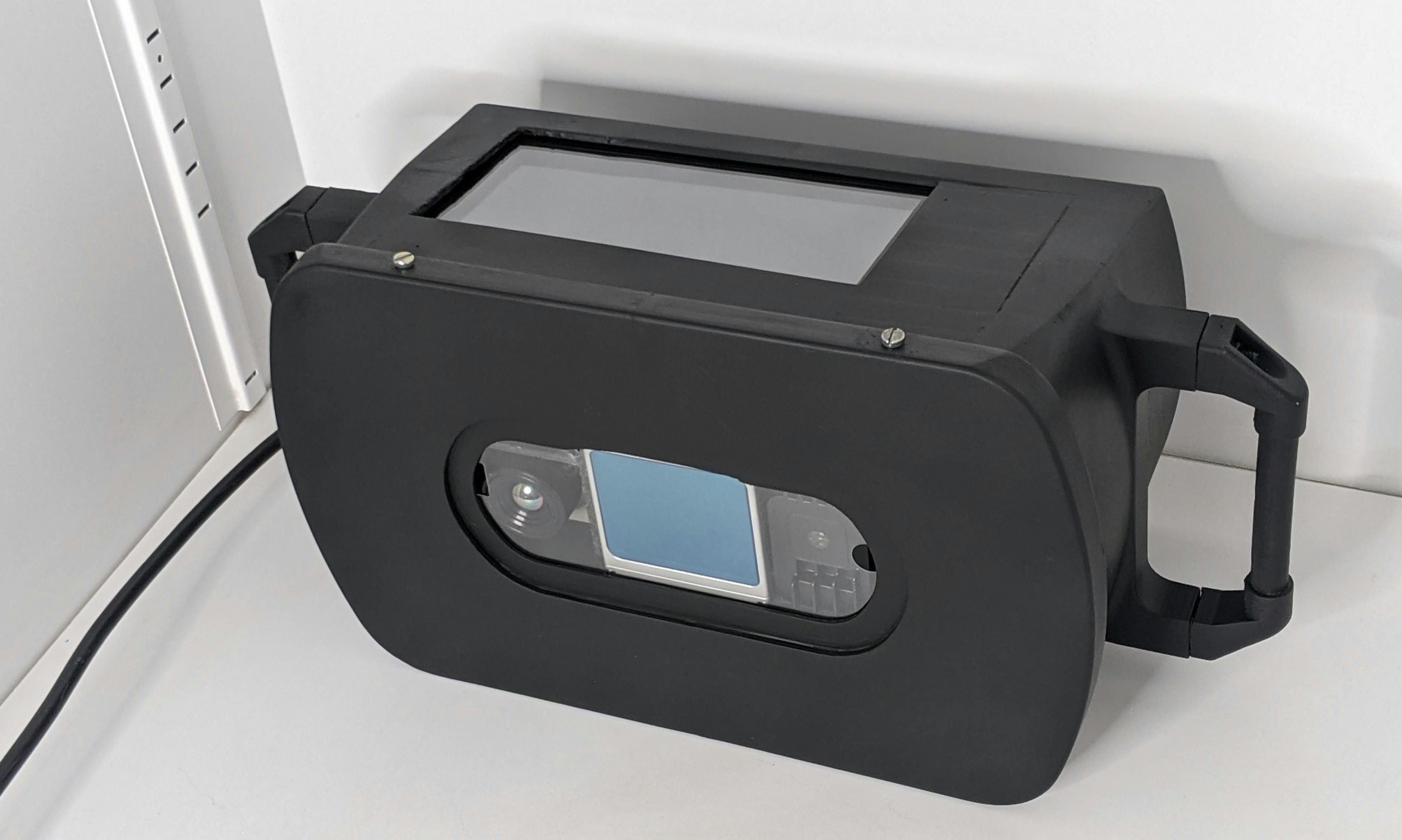
LITHIC
LITHIC is the acronym for Lidar-Thermal-IMU-Camera. It Includes a 360 LiDAR, IMU sensors, RGB camera, Thermal Camera and a Multi Spectral Camera
905nm
100m
360/70° FOV
200K points/sec
2mm std
Global Shutter
Thermal Camera
Multi-Spectral Camera
2TB Storage
2.5hr Batttery
1.5 hr Data
1.7kg
Drone Scanning
Drone LITHIC
Capture Process
Geolocation
Output Process
LITHIC Drone Specifications
GPS Denied Navigation
Obstacle Avoidance
20min flight time
Mission Automation
2kg payload
80m max height
The Measurable 3D Model!
3D Mesh
2D Plan
Measurements
Accuracy
Section Planes
Volume-under-Plane
Snapping
Annotations
Google Maps
2D Floor Plan
Segmented Model
Measurements

DXF

PLY

GLTF

OBJ

RVT

IFC
Stacked Model on Google Maps
Stacking Process
Navigation
Map Layers
Side-By-Side View
3D Scan vs Camera Video
3D Scan vs BIM Model
RGB vs Thermal
Slider View
Old Scan vs New Scan
"Peel Off"
Scan History
Thermal Analytics
Processing
Moisture Seepage
Leak Profiling
Defect Analytics & Punch Lists
Snags AI
Annotated in 3D
AI Training
Task Manager
Annotations to Task
Task Features
Access Controls
Health&Safety Analytics
Facial Recognition
PPE Detection
AI Reports